

Ballinamore
Irish name: Béal an Átha Móir
The market town halfway along the waterway, with a fully serviced marina, shops for a restock and some of the best traditional pubs on the route.
- Public
- Shore power
- Pump-out
- Not yet checked: berths, water, fuel and price
Desk research, not yet checked on site · Position: © OpenStreetMap contributors · Report a change
Moor here
Ballinamore Marina
PublicMarina · open to all boats
Current availability unknown
Report space · Seven-day history- Shore power
- Yes
- Pump-out
- Yes
Not yet checked: operator, berths, boat length, water, fuel, price and contact
About this mooring
Max. stay: Up to 5 days in a row or 7 days in a month, all year unless you have a winter mooring
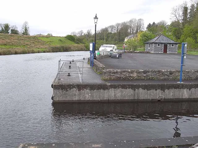
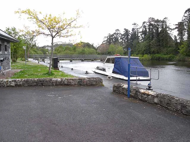
Public marina just above lock 6, a short walk from the main street; shore power, service block (toilets, showers, laundry), pump-out and slipway.
Report a problem here (power, water, weed, depth)
Anonymous. These reports go privately to our editors and are not shown on the card. To tell other boaters, sign in and use “Report now” or “Report a problem” above. Privacy
Mooring limit: 5 days in a row, 7 days a month
Public moorings on the Shannon Navigation and the Shannon–Erne Waterway: at the same public harbour for at most 5 days in a row, or 7 days in total in any month, all year round. A longer stay in winter (1 November to 31 March) needs a winter mooring from Waterways Ireland. Boater information from Waterways Ireland
From here
1 itinerary
- Itineraries that stop here
- In the guide
Today
- Loading today’s conditions…
Forecast, warnings and water levels
Weather and water
Loading the latest conditions…
About Ballinamore
Ballinamore, the “mouth of the big ford” on the Yellow River, is the only real town between Leitrim and Ballyconnell and the obvious place to restock, about 22 km and ten locks from Leitrim. The marina lies just above lock 6 and has toilets, showers, laundry, a pump-out, a slipway and shore power; a 4.5 km looped walk along the waterway starts from it. Shops, cafés, restaurants, a hotel and plenty of pubs line the streets of the town. Waterways Ireland puts Smyth’s Siopa Ól, with its stone floors and open fires, in the running for best pub on the waterway. Look out for the 1830s courthouse and the old arched bridge; from 1887 to 1959 the town was also the hub of the narrow-gauge Cavan and Leitrim Railway.
Eat & drink
Smyth’s Siopa Ól
Old-school pub on Main Street with stone floors, open fires and hearty food such as beef stew; music on some evenings.
+353 71 964 4955Things to do
- Walk
Ballinamore looped walk
An easy loop of about 4.5 km from the marina along the waterway to Ardrum Lock and back through the town, suitable for walkers, cyclists and children.
Website (opens another website)
Services
- Shore power
- Laundry
- Pump-out
- Showers
- Slipway
- Toilets
Pump-outs, showers and shore power at Waterways Ireland harbours are paid with a Waterways Ireland Smart Card. About the Smart Card
Commercial & Tourist Hotel
Family-run hotel in the town centre, a few hundred metres from the waterway, with a restaurant, a bar and turf fires.
+353 71 964 4675 hotelcommercial.com (opens another website)Neighbours by water
- Ballinamore Lock Next opening 09:00 (in 4 h 57 min)
- Ardrum Lock Next opening 09:00 (in 4 h 57 min)
- Ballyduff Lock Next opening 09:00 (in 4 h 57 min)
Show 3 more
- Aghoo Lock Next opening 09:00 (in 4 h 57 min)
- Castlefore Lock Next opening 09:00 (in 4 h 57 min)
- Keshcarrigan
≈ distances are computed along the water, not along the marked channel. Times are our estimate: 5 km/h and 20 minutes a lock. Check the Waterways Ireland marine notices
Photos 3 photos
No photos match these filters yet.
-
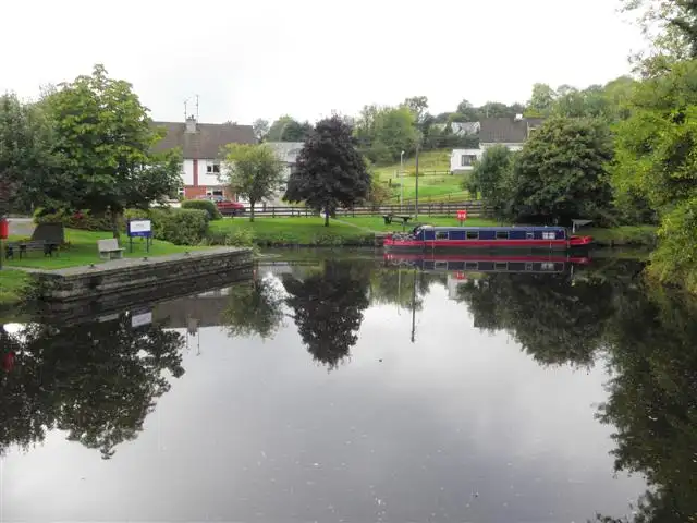
Other sources · Not known “Canal, Ballinamore” by Kenneth Allen · Wikimedia Commons · CC BY-SA 2.0 · Changes: resized and re-encoded -
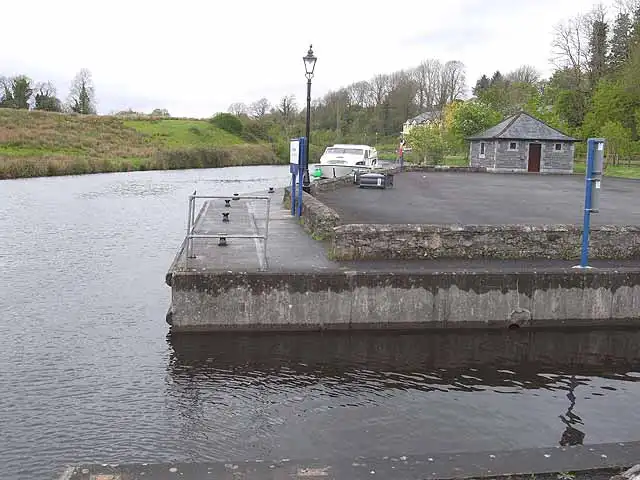
Other sources · Not known “Ballinamore Mooring, Shannon-Erne Waterway” by Oliver Dixon · Wikimedia Commons · CC BY-SA 2.0 · Changes: resized and re-encoded -
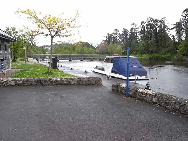
Other sources · Not known “Ballinamore Mooring, Shannon-Erne Waterway” by Oliver Dixon · Wikimedia Commons · CC BY-SA 2.0 · Changes: resized and re-encoded
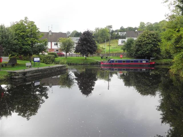


Also nearby, from OpenStreetMap (5)
Not checked by us. Tap a group to open it. © OpenStreetMap contributors
Services (3)
Harbours & marinas from OpenStreetMap — access not checked (1)
Locks & bridges (1)
© OpenStreetMap contributors