Navigation marks
How to read the red and green marks on the Shannon, the white-sided marks on Lough Erne, the canals' lack of them, and the other signs you will meet on the water.
Updated 23 Oct 2026
On this page
The navigable channel through Ireland's lakes and rivers is marked with poles, posts and buoys. They are there because just outside them are rocks, shallows and reed beds. The golden rule everywhere: stay in the marked channel, pass marks at a sensible distance, and never cut corners between them.
Good to know: This is a travel guide, not a navigation aid. The marks layer on our map comes from OpenStreetMap and may be incomplete or out of date. Steer by the official chart, the marks on the water and your hire company's briefing.
The Shannon: red and green
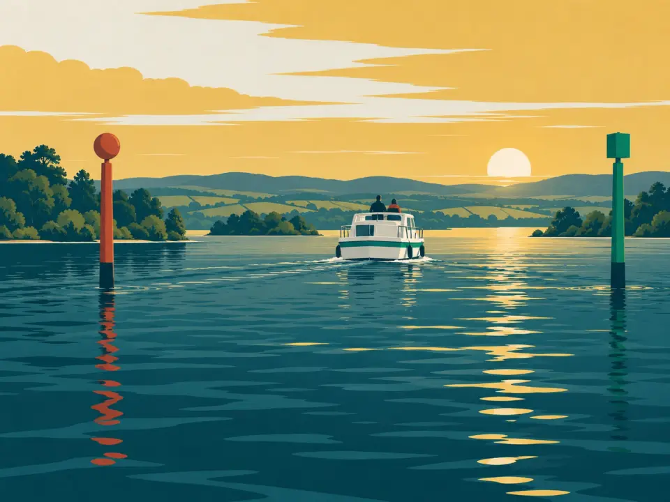
The Shannon uses lateral marks: red marks on one side of the channel, green marks on the other. Which side you keep them depends on your direction.
- Going upstream (north, towards Lough Allen) and when entering a bay or harbour: keep red on your left (port) and green on your right (starboard).
- Going downstream (south, towards Limerick) and when leaving a bay or harbour: keep green on your left and red on your right.
That is how the summary of the Shannon Navigation Bye-laws 1992 printed on the Shannon navigation charts puts it, and it matches the international (IALA A) system used around Ireland's coast. A memory aid: going upstream, there is no red port left: red, port, left.
On the lakes the "upstream" direction is the river's: on Lough Derg it runs from Killaloe north to Portumna, on Lough Ree from Athlone north to Lanesborough. In the middle of a lake, in a bay or near an island the arrangement can be confusing. Find the mark's number on your chart, work out which side the safe water is, and if in doubt slow down and keep well off.
Older paper charts may show the starboard marks in black: the Shannon's starboard marks used to be black and were changed to green under the international (IALA) system (Boating Innovation chart notes).
The Shannon’s marks at a glance
Going upstream towards Lough Allen, and into a bay or harbour
Going downstream towards Limerick, and out of a bay or harbour
- Going upstream Red on your left, green on your right.
- Going downstream Green on your left, red on your right.
The same shapes and colours as on our map.
- Port-hand mark Upstream, keep it on your left.
- Starboard-hand mark Upstream, keep it on your right.
- Special mark Usually a race course: slow down and keep clear.
Circle = port, square = starboard, diamond = special. Not for navigation: steer by the official chart and the marks on the water.
Lough Erne works differently: pass each mark on its white side.
Lough Erne: keep to the white side
The Erne marks work differently: each mark shows a white side, and you pass each mark on its white side. Fishing guides to the lough say the same: keep to the white side of the navigation markers and you stay in relatively deep water (Lower Lough Erne angling map, DAERA). Marks on Lough Erne are numbered, which makes checking your position on the chart easy.
The Erne Charter Boat Association's chart adds sound advice for the lakes (Erne Waterway Chart): never cruise close to the shore, give islands a wide berth of 50 to 100 metres unless there is a jetty, check your position on the chart often, and check the forecast before crossing the open parts of Lower Lough Erne. Ignore any old marks the chart tells you to ignore.
Because the systems differ, our map does not show the marks layer in the Erne regions until we have a key we trust.
The canals: no marks, stay in the middle
The Grand Canal, Royal Canal and the Barrow Line are narrow and generally unmarked. Keep to the middle, slow down at bends and bridges, and watch the depth in summer: on the Barrow the depth available can drop to about 0.76 m (Waterways Ireland). Weirs beside the river locks are dangerous; follow the signs to the lock cut.
Lower Bann and Lough Corrib
On the Lower Bann, the navigable arch of each bridge is shown by a downward arrow above it, and coloured lines on the shore mark the zones for water skiing and fast boats (Waterways Ireland). Lough Corrib is not a Waterways Ireland navigation: its marks are kept by the Lough Corrib Navigation Trustees, who are moving the lake to standard red and green marks, working from the river at Galway north towards Maam. Under the old system red marks were kept to starboard going north (or anticlockwise around Ashford and Oughterard), so on a stretch that has not been converted yet the colours can mean the opposite: ask locally before you rely on them. Old GPS charts may show a layout that no longer exists (IWAI Corrib branch).
Other marks and signs
- Yellow buoys in summer usually mark sailing race courses on Lough Derg, Lough Ree and Lower Lough Erne. Slow down and keep clear; power gives way to sail (Special Marine Notice 1/2026).
- "X" buoys marked "Danger" on Lough Ree mark the Defence Forces firing range. Boats may not enter it.
- Bridges: use the marked navigation arch. Where there is more than one, take the arch on your right, and when going upstream give way to boats coming down.
- Meeting another boat: keep to the right-hand side of the channel and pass each other port to port (left side to left side).
- High water can hide marks and reduce the clearance under bridges. Low water makes the edges of the channel shallower: stay near the centre line.
Floating marks can drift off station after storms or floods. Waterways Ireland asks boaters to report damaged or moved marks to the Inspectorate (Special Marine Notice 1/2026); IWAI's Nav-Watch form passes reports on too.
Our map's marks layer
Switch on Marks & routes on the map to see marks mapped in OpenStreetMap, with a key for each region where we have one. Use it to understand the chart, not instead of it.
In an emergency
Call 112 or 999 and ask for the Coast Guard. Both numbers work in Ireland and in Northern Ireland.
Safety on the waterIn an emergency
Call 112 or 999 and ask for the Coast Guard. Both numbers work in Ireland and in Northern Ireland.
Safety on the water