

Salmon Weir Bridge
The bridge at the foot of the navigation in Galway city: the weir beside it controls the lake's level, and boats go no further downstream.
Photo: Qwertzu111111 · CC BY-SA 4.0
More lakes Lake Ireland
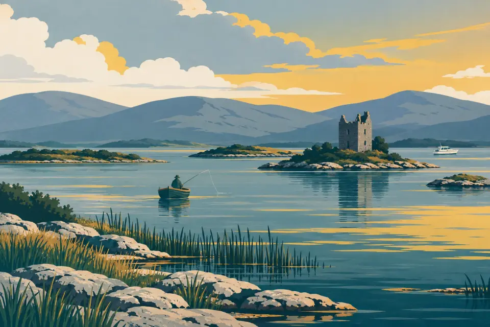
Ireland's second-largest lake: a short river up from Galway city, then 176 km² of rocky, island-strewn water reaching to Cong, Ashford Castle and the Joyce Country hills at Maam.
Days and hours are our estimate: 7.5 km/h and 15 minutes a lock, about six hours a day.
Start from a ready-made trip, or plan your own day by day: distances, locks and overnight moorings.
Lough Corrib covers 176 km² of the west of Ireland, almost all of it in County Galway, with its north-east corner in Mayo. It drains to the sea through Galway city by a river only 6 km long, and that is where the navigation begins: at Woodquay, just above the Salmon Weir. Upstream, the river passes the ruin of Menlo Castle and reaches the lake through Friar's Cut, a channel said to date from the 12th century. The shallow lower lake, with Annaghdown's abbey ruins on its east shore, narrows between Knockferry and Kilbeg and then opens into the larger, deeper upper lake, scattered with islands: tradition says there are 365, a modern chart counts more than 1,300. Oughterard, the main angling town, sits on the west shore; Cong, Ashford Castle and the monastic island of Inchagoill lie to the north; and a long arm runs west under the Joyce Country hills to Maam. Steamers once linked Galway and Cong, and two cruise companies carry visitors today. This is wild brown trout water, at its busiest in the May fly season.
13 stops around the lake.
Desk research, not yet checked on site
The bridge at the foot of the navigation in Galway city: the weir beside it controls the lake's level, and boats go no further downstream.
Photo: Qwertzu111111 · CC BY-SA 4.0

Galway city's start of the Corrib navigation: Woodquay and Steamers Quay, where the Corrib Princess boards for the lake.
Photo: Bob Linsdell · CC BY 3.0

A Gaeltacht village on the river just below the lake, with a small pier and the burnt-out shell of the Blakes' Menlo Castle on the bank.
Photo: Marathon · CC BY-SA 2.0

A limestone pier of about 1875 on the lower lake's east shore at Annaghdown, home of medieval abbey and cathedral ruins.
Photo: Newbert12 · CC BY-SA 4.0

A public pier on the west shore at the narrows, where Lough Corrib's shallow lower lake meets the larger upper lake.
Photo: Gordon Hatton · CC BY-SA 2.0
A short pier on the east shore at the narrows, once a call of the Galway–Cong steamers and now used mostly by anglers.
Headford's harbour on the east shore of the upper lake, a famous angling berth with a causeway out to Inchiquin, one of the lake's largest islands.
The Corrib's main angling town on the west shore, with a public pier from which Corrib Cruises sail to Inchagoill and Cong.
A wooded island halfway between Oughterard and Cong, with two early churches and a pillar stone carved with one of Ireland's oldest inscriptions in Latin letters.
Cong's public pier on the upper lake, given a new slipway and floating pontoon in 2023 and the departure point for Corrib Cruises' trips.

The Quiet Man village on the isthmus between Lough Corrib and Lough Mask, with an Augustinian abbey, the Monks' Fishing House and Ashford Castle on the shore.
Photo: Geyo John · CC BY-SA 3.0
A Gaeltacht village of the Joyce Country on the north shore of the lake's western arm, with a public pier, a shop and a pub.
The head of the lake in the Joyce Country, where Maam Bridge crosses the Bealnabrack River and Nimmo's old inn is now Keane's pub.
Mooring limits, locks, speed and hazards, in our own words with links to the sources.
Lough Corrib is not one of Waterways Ireland's navigations. The Lough Corrib Navigation Trustees, a local authority run through Galway City Council (Lough Corrib Navigation Act 1945), look after the navigation marks and a few piers (IWAI Corrib: the Trustees' history). There is no Smart Card, lock key or Shannon-style five-day rule, and we know of no published time limit at the piers. Anglers and cruise boats use them too, so keep landing steps and departure berths clear.
In 2015 the Trustees began moving the lake to IALA Region A buoyage in five phases, from the river north to Maam: red can-shaped marks to port and green cones to starboard in the direction of buoyage. Under the old system, red marks were kept to starboard and black ones to port heading north. GPS charts made before the change show the old layout and can lead you into danger (IWAI Corrib notice, November 2015).
The Eglinton Canal down to Galway Bay has been closed to boats since its swing bridges were blocked in 1934; the Trustees abandoned it in 1948 (IWAI Corrib). The Cong Canal was never finished. Above Woodquay the river passes under the Quincentenary Bridge; we have found no published headroom figure.
Rocks and shoals lie just below the surface all over the lake, and Fáilte Ireland advises newcomers to take a local guide (Discover Ireland). Keep to the marks, read Met Éireann's forecast for Lough Corrib and Lough Mask, and expect curly-leaved waterweed in some bays. Personal watercraft are banned (WI Marine Notice 29 of 2021). Weed fragments and zebra mussels travel on hulls and trailers, so clean both before moving to another lake (IWAI Corrib: invasive species). Emergency: dial 112 or 999 and ask for the Coast Guard.
This is a travel guide, not a navigation aid.
Loading the latest conditions…
No locks on this waterway.
No lock or bridge times listed yet.
All lock and bridge times Check the Waterways Ireland marine notices
Ready-made trips that start here or pass through.
No events listed for this waterway yet.
Current Waterways Ireland marine notices for this waterway.
Source: Waterways Ireland · All marine notices on Waterways Ireland
Our marketplace buz.ie
On buz.ie by county: Co. Galway (opens buz.ie in a new tab) Co. Mayo (opens buz.ie in a new tab)
Places on the map that are not near one of our stops. Listed on OpenStreetMap, not checked by us. © OpenStreetMap contributors