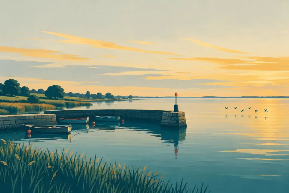
Illustration: a small stone harbour with rowing boats on the vast, flat water of Lough Neagh under a wide evening sky.

More lakes Lake Northern Ireland

Lough Neagh & Lower Bann

Ireland's largest lake and the river that drains it to the north coast: open water ringed by council marinas, then 52 km of the Lower Bann through five keeper-worked locks to Coleraine.

At a glance

Days and hours are our estimate: 7.5 km/h and 15 minutes a lock, about six hours a day.

Plan your cruise

Start from a ready-made trip, or plan your own day by day: distances, locks and overnight moorings.

Overview

Lough Neagh is the biggest lake in Ireland and Britain, about 31 km long and 14 km wide, shallow around the edges and quick to throw up short, steep waves when the wind rises. Five of Northern Ireland's six counties touch its shores. No navigation authority looks after the lough, so its harbours are run by councils, clubs and volunteers: Kinnego beside Oxford Island in the south, Ballyronan and the Battery at Ardboe on the west shore, Antrim's lough shore in the north-east, and a private marina at Sandy Bay facing Ram's Island. At Toome the water leaves through a lock and sluice gates into the Lower Bann, which Waterways Ireland manages for 52 km to Coleraine. The river crosses reedy Lough Beg, passes Portglenone and Kilrea and steps down through five locks, including a double one at Portna. Below the Cutts it becomes tidal, and Coleraine's harbour and marinas lead on to the Atlantic at the Barmouth. Eel fishing, sand barges and huge flocks of wintering wildfowl give the whole area its own character.

Stops, in route order

25 stops from Kinnego Marina to Seatons Marina.

Desk research, not yet checked on site

Kinnego Marina to Sandy Bay Marina 8 stops

Yachts and motor boats moored at the pontoons of Kinnego Marina, seen across the calm basin from a grassy, stony bank.

Marina · Co. Armagh

Kinnego Marina

The largest marina on Lough Neagh, a council harbour on the edge of the Oxford Island nature reserve with visitor berths, a café, a slipway and the headquarters of Lough Neagh Rescue.

Public 1 mooring 1 place to eat and drink

Photo: Robert Ashby · CC BY-SA 2.0

Low, wooded Coney Island lies out on Lough Neagh under dark clouds, seen past tall grasses and trees on the shore of Maghery Country Park.

Island · Co. Armagh

Coney Island

A wooded National Trust island a kilometre off Maghery, once an O'Neill stronghold, where the remains of a 16th-century stone tower still stand.

Photo: Stephen McKay · CC BY-SA 2.0

The channel at Maghery slip opens onto Lough Neagh between leafy banks, with a marker post in the water and wooded Coney Island on the horizon.

Village · Co. Armagh

Maghery

A small village at the mouth of the Blackwater, with a council country park, jetties and a slipway, and the shortest crossing to Coney Island.

Not yet checked 1 mooring

Photo: P Flannagan · CC BY-SA 2.0

Motor boats moored in the small Battery harbour on Lough Neagh, reflected in calm water, with a jib crane, a jetty and the open lough beyond.

Harbour · Co. Tyrone

Ardboe Battery Harbour

A small public harbour on the Tyrone shore near Ardboe, shared with the lough's fishing boats and a Lough Neagh Rescue station, close to the tenth-century Ardboe Cross.

Public 1 mooring

Photo: Kenneth Allen · CC BY-SA 2.0

Boats moored along the jetties of Ballyronan Harbour, seen from the slipway across calm water under a cloudy sky.

Village · Co. Londonderry

Ballyronan

A lakeside village that began as a little port in 1788, with a Blue Flag council marina where visiting boats may stay up to seven nights on jetty one.

Public 1 mooring

Photo: Henry Clark · CC BY-SA 2.0

Calm water at Antrim’s lough shore, with the jetty and white railings of Antrim Boat Club on the right and Lough Neagh opening out beyond.

Town · Co. Antrim

Antrim

Antrim's lough-shore park at the mouth of the Six Mile Water, with a council jetty and slipway, Antrim Boat Club, The Gateway visitor centre and a riverside path to Antrim Castle Gardens.

Not yet checked 2 moorings 1 place to eat and drink

Photo: Sourabh.biswas003 · CC BY-SA 4.0

Island · Co. Antrim

Ram's Island

The largest island on Lough Neagh, about a mile off Sandy Bay, with a round tower, the ruins of the O'Neills' summer house, and volunteer-run day trips and camping in summer.

By arrangement 1 mooring
Aerial view of the Lough Neagh shore at Sandy Bay, with boats in and around the small marina basin, sand heaps at a quay to the right and patchwork fields behind.

Marina · Co. Antrim

Sandy Bay Marina

A private marina of about 60 berths on the quiet east shore, facing Ram's Island, from which the island's summer day trips leave.

Private · not yet checked 1 mooring

Photo: Thomas Nugent · CC BY-SA 2.0

Lower Bann Toome Lock to Seatons Marina · 17 stops

The red-painted sluice gates across the River Bann at Toome, with the blue arch of the bypass bridge and an electricity pylon behind them.

Lock · Co. Antrim

Toome Lock

The lock and sluice gates at the head of the Lower Bann, where boats leave Lough Neagh through the Toome Canal, worked by a lock-keeper for £1.

Next opening Sat, 31 Oct at 10:00

Photo: Robert Ashby · CC BY-SA 2.0

The River Bann at Toome flows wide and calm under a low road bridge, with trees on both banks, a railed walkway on the right and patches of weed on the water.

Village · Co. Antrim

Toome

The village at Lough Neagh's outlet, home of Europe's largest wild eel fishery, with a canal-side jetty, cafés and a country-house hotel.

Public 1 mooring 3 places to eat and drink

Photo: Rossographer · CC BY-SA 2.0

Island

Lough Beg & Church Island

A shallow lake and nature reserve on the river below Toome, crossed by a channel marked with perches, with the lone spire of Church Island near its western shore.

Jetty

Newferry

An old ferry crossing just below Lough Beg, now the water-ski centre of the Lower Bann, with jetties, slipways and council facilities on both banks.

Public 1 mooring
Small boats lie at the pontoons and wooden jetties of Portglenone’s marina on the calm River Bann, with village houses and trees reflected beyond.

Village · Co. Antrim

Portglenone

A riverside village with a 35-berth council marina by the bridge, low visitor rates and an ancient bluebell wood half a mile away.

Public 1 mooring 3 places to eat and drink

Photo: Chris Morgan · CC BY-SA 2.0

Boats moored along the bank in the calm cut leading to Portna Lock, with the lock gates and walkway at its end and a blue sign beside them.

Lock · Co. Londonderry

Portna Lock

The Lower Bann's only double lock, on a short cut on the west side of the river near Kilrea, with a dry dock above it and showers, water and a campsite.

Next opening Sat, 31 Oct at 10:00

Photo: Aubrey Dale · CC BY-SA 2.0

Kilrea Bridge, a long stone bridge of several arches, crosses the Bann between green banks, with ivy along the parapet in the foreground.

Village · Co. Londonderry

Kilrea

A market village on the Derry bank just below Portna, reached from the Portneal jetty by Kilrea Bridge, with a big inflatable water park on its own lake.

Public 1 mooring 1 place to eat and drink

Photo: David Purchase · CC BY-SA 2.0

The straight Movanagher Canal runs between a bank of bare trees and a narrow lane, with a small concrete landing stage on the near side under a grey sky.

Lock · Co. Londonderry

Movanagher Lock

A quiet lock in open country about 5 km below Kilrea, worked by the keeper who also covers Carnroe, with showers, water, a slipway and a small campsite.

Next opening Sat, 31 Oct at 10:00

Photo: Robert Ashby · CC BY-SA 2.0

Aerial view of Carnroe on the Lower Bann, with the long white weir across the river, the lock cut and houses on the left and green fields beyond.

Lock

Carnroe Lock

The fourth lock down from Toome, a short run below Movanagher and worked by the same lock-keeper, with toilets and canoe steps.

Next opening Sat, 31 Oct at 10:00

Photo: Stephen Taggart · CC BY-SA 2.0

Motor cruisers moored at the pontoons of Drumaheglis Marina, mirrored with white clouds in the still water of the Bann.

Marina · Co. Antrim

Drumaheglis Marina

A five-star council holiday park and 32-berth marina on the Lower Bann near Ballymoney, and the base of Bann River Cruises' self-drive cruisers.

Public 1 mooring 1 place to eat and drink

Photo: Shane Killen · CC BY-SA 2.0

Looking from a green gate beam along the long stone chamber of the lock at the Cutts, with the River Bann and wooded banks beyond.

Lock

The Cutts Lock

The last lock on the Lower Bann, at the Cutts above Coleraine, below which the river is tidal, with the Stone Age site of Mountsandel just downstream.

Next opening Sat, 31 Oct at 10:00 Public 2 moorings

Photo: Aubrey Dale · CC BY-SA 2.0

Bridge · Co. Londonderry

Coleraine Bridge

Coleraine's old stone town bridge, the lowest fixed clearance between Lough Neagh and the sea: about 4.2 m at low water but only around 1.5 m at high water.

Town · Co. Londonderry

Coleraine

The river town at the lowest crossing of the Bann, with secure harbour pontoons in the town centre and Mountsandel, one of the oldest settlements in Ireland, a short walk upstream.

By arrangement 1 mooring
Aerial view of a blue-hulled cargo ship passing through the raised lifting span of the railway bridge over the Bann at Coleraine, with the town and its quays beyond.

Bridge · Co. Londonderry

Coleraine Railway Bridge

Translink's lifting railway bridge just below Coleraine town centre, with about 4.9 m of clearance at the highest tides; lifts on request, fitted around the trains.

Photo: KS · CC BY-SA 2.0

Marina · Co. Londonderry

Coleraine Marina

The council marina about a mile below Coleraine on the east bank, the usual visitor stop on the tidal Bann, with boat fuel, a travel-lift and a mast-lowering facility.

Public 1 mooring

Marina · Co. Londonderry

Cranagh Marina

A privately run riverside marina and holiday complex between Coleraine and Portstewart, with over 200 m of deep-water pontoons; visitors by arrangement.

By arrangement 1 mooring

Marina · Co. Londonderry

Seatons Marina

A small family-run private marina two miles below Coleraine and three miles from the sea, which takes visiting boats when it has a free space and they have booked ahead.

By arrangement 1 mooring
Show all 25 stops Show fewer stops

Services along the way

17 stops

Pump-out, water, fuel, shore power, showers and laundry where a listing says so, in route order. Tap a stop for who runs it and when.

  1. Kinnego Marina Showers Toilets Laundry
  2. Maghery Toilets
  3. Ballyronan Toilets
  4. Sandy Bay Marina Drinking water Shore power
  5. Toome Lock Drinking water Toilets
  6. Newferry Drinking water Showers Toilets
  7. Portglenone Pump-out Drinking water Shore power Showers Toilets Laundry
  8. Portna Lock Drinking water Showers Toilets
  9. Kilrea Drinking water
  10. Movanagher Lock Drinking water Showers Toilets
  11. Carnroe Lock Toilets
  12. Drumaheglis Marina Pump-out Drinking water Shore power Showers Toilets Laundry
  13. The Cutts Lock Drinking water Showers Toilets
  14. Coleraine Drinking water Shore power Toilets
  15. Coleraine Marina Pump-out Drinking water Fuel Shore power Showers Toilets Laundry
  16. Cranagh Marina Drinking water Shore power Showers Toilets
  17. Seatons Marina Drinking water Shore power Showers Toilets

A stop not listed here may still have them: nobody has checked yet. Know better? Report a change

Practical rules

Mooring limits, locks, speed and hazards, in our own words with links to the sources.

Who is in charge

Lough Neagh has no navigation authority and no statutory boating rules. The Department for Infrastructure keeps up the marks, a modified IALA cardinal and lateral system numbered 1–47 clockwise from the Toome Canal entrance (Kinnego Marina, DfI). From Toome to Coleraine the Lower Bann is a Waterways Ireland navigation; below Coleraine's old bridge, Coleraine Harbour Commissioners are the authority (notice).

Mooring

The Lower Bann's public moorings have no time limit, and there is no winter mooring. On the lough each marina sets its own terms: at Ballyronan visitors may stay up to 7 nights on jetty one.

Locks

Five locks (Portna is double), 35 m × 5.5 m, draft 1.2 m, all worked by lock-keepers for £1 a lock, £0.50 each when two or more boats share. Hours: April–May 10:00–18:30, June–August 09:00–20:00, September–October 10:00–18:00, November–March 10:00–16:00, closed 13:00–14:00. Phone the keeper before setting off (boater information). From 1 November to 17 March, also check with Waterways Ireland that the river is open.

Bridges

Coleraine's town bridge clears about 4.2 m at low water but only 1.5 m at high water. The railway bridge below it lifts on request around the trains (VHF 12).

Hazards

The lough gets rough quickly, and river mouths and quays silt up. After heavy rain the river runs in spate, with strong currents at the Cutts, Portna, Movanagher and Carnroe. Toxic blue-green algae has bloomed every summer since 2023 (Wikipedia): if in doubt, stay out of the water and keep dogs on a lead (DAERA). At the Barmouth, breakers on Portstewart pier mean the bar may be impassable.

Weather and help

Warnings come from the Met Office. In an emergency dial 999 and ask for the Coastguard; Lough Neagh Rescue has stations at Kinnego, Ardboe and Antrim.

This is a travel guide, not a navigation aid.

Conditions on the water

  • Loading today’s conditions…
Forecast, warnings and water levels

Weather and water

Loading the latest conditions…

Locks & bridges

5 locks on this waterway. The times below are worked out on this device. They change with the season: always read the notice.

  • Toome Lock Lock · Worked by a lock-keeper
    Next opening Sat, 31 Oct at 10:00
  • Portna Lock Lock · Worked by a lock-keeper
    Next opening Sat, 31 Oct at 10:00
  • Movanagher Lock Lock · Worked by a lock-keeper
    Next opening Sat, 31 Oct at 10:00
  • Carnroe Lock Lock · Worked by a lock-keeper
    Next opening Sat, 31 Oct at 10:00
  • The Cutts Lock Lock · Worked by a lock-keeper
    Next opening Sat, 31 Oct at 10:00

Itineraries

Ready-made trips that start here or pass through.

All itineraries

Events

No events listed for this waterway yet.

All events Tell us about an event

Marine notices

Current Waterways Ireland marine notices for this waterway.

Show 4 more

Source: Waterways Ireland · All marine notices on Waterways Ireland

More on the map, from OpenStreetMap

Places on the map that are not near one of our stops. Listed on OpenStreetMap, not checked by us. © OpenStreetMap contributors

Harbours & marinas from OpenStreetMap — access not checked (3)
Food & drink (9)
Shops (4)
Locks & bridges (5)
Things to do (10)
Services (10)